UN
29 Barnham Road
£ 190,000
Description
We don't have a Description for this property.
- Bedrooms
- 3
- Bathrooms
- 0
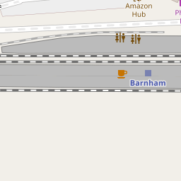

Leaflet © OpenStreetMap contributors
The heatmap indicates the level of crime in the area. The color of the heatmap indicates the crime severity and recency.
Metrics Year-on-Year
- Average area value
- 761,083.00 £Increased by 6.90 %
- Average area rental value
- 2,056.00 £/moDecreased by 3.34 %
- Est rental Yield
- 3.24 %Decreased by 9.75 %
- Crime Rate
- 203.00 %Unchanged by 0.00 %
from 711,963.00 £
from 2,127.00 £/mo
from 3.59 %
from 203.00 %
Nearby Schools
| Name | Type | Ofsted | Distance |
|---|---|---|---|
| St Philip Howard Catholic School | Academy Converter | Outstanding | 0.43 KM |
| Barnham Primary School | Academy Converter | Good | 0.48 KM |
| Eastergate Cofe Primary School | Voluntary Controlled School | Good | 2.37 KM |
| Ormiston Six Villages Academy | Academy Sponsor Led | Good | 2.68 KM |
| Walberton And Binsted Cofe Primary School | Voluntary Controlled School | Good | 2.84 KM |
Images
Nearby Streets
| Name | Average Price | Average Sqft | Distance |
|---|---|---|---|
| Marshall Close | £ 350,000 | 0 | 0.00 KM |
| Nursery Close | £ 0 | 0 | 0.00 KM |
| Canal Mews | £ 0 | 0 | 0.00 KM |
| Park Road | £ 475,000 | 0 | 0.00 KM |
| Freeman Close | £ 0 | 0 | 0.00 KM |
Nearby Transport
| Name | NLC | TLC | Distance |
|---|---|---|---|
| Barnham | 5252 | BAA | 0.23 KM |
| Bognor Regis | 5253 | BOG | 6.30 KM |
| Ford | 5258 | FOD | 6.99 KM |
Nearby Listings
| Address | Price | Type | Score | Distance |
|---|---|---|---|---|
| Barnham Road, Barnham | £ 70,000 | BUY | 5 / 10 | 0.01 KM |
| Windmill Court, Bognor Regis, PO22 0DY | £ 125,000 | BUY | Unknown | 0.07 KM |
| Barnham Road, Barnham, Bognor Regis, West Sussex, PO22 | £ 105,000 | BUY | 5 / 10 | 0.08 KM |
| The Cedars, Barnham, Bognor Regis, West Sussex, PO22 | £ 355,000 | BUY | 6 / 10 | 0.17 KM |
| Gospond Road, Barnham | £ 399,950 | BUY | 5 / 10 | 0.18 KM |
Nearby Properties
| Address | Price | Distance |
|---|---|---|
| 43a Barnham Road | £ 16,550 | 0.00 KM |
| 29 Barnham Road | £ 190,000 | 0.00 KM |
| 35 Barnham Road | £ 32,000 | 0.02 KM |
| 34 Market Close | £ 215,000 | 0.12 KM |
| 16 Market Close | £ 160,000 | 0.12 KM |